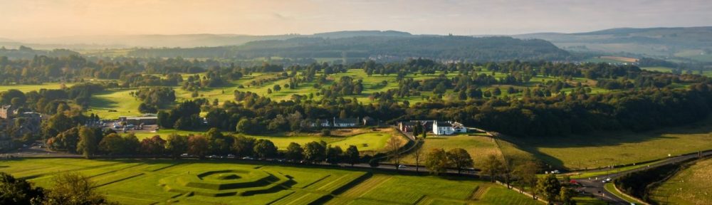
Wednesday, May 22, 2013
Dad and I spent almost an hour last night looking at Google Earth and our GPS system, and found a much easier (and considerably shorter) route to Tre’r Ceiri than the one recommended by Trekking Britain.
Tre’r Ceiri Hill Fort
We stopped at a lay-by on the B4417 out of Llithfaen, went through a gate and headed up a clearly visible path. The path was steep in places, and very rocky, but the effort was worth it when we reached the top.
Tre’r Ceiri is an iron-age hill fort, built sometime in the first century BC. It was constructed of scree from the hillside, stacked up to form the walls of more than 150 round houses like the ones shown in the photo. The entire collection of houses was surrounded by a 12-foot wall, which was capped by a stone rampart.
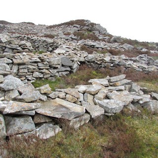
A few of the round houses at Tre’r Ceiri
The fort was occupied throughout the Roman period, with archaeological finds showing it was inhabited as late as the fourth century. One of the main characters in my series has his court at Tre’r Ceiri.
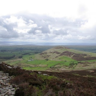
View from the top of Tre’r Ceiri
Although the landscape is exceptionally rugged, with nothing more than gorse growing on the hillside, the views from the top of the Tre’r Ceiri mount are spectacular, and would have provided the people who lived here with ample warning of approaching visitors.
The wind off the sea was freezing cold, and much stronger than I expected it to be. It actually made it difficult to breathe and almost impossible to hear; Dad had to shout directions until we left the northern part of the fort and the walls blocked some of the wind again. If you plan to visit, don’t forget your gloves!
Directions:
To reach Tre’r Ceiri, follow the B4417 out of Llithfaen until you reach the lay-by at coordinates 4°24’56”W, 52°58’14”N. There is a sign that says simply “Tre’r Ceiri,” and room for 2 or 3 cars to park here. Follow the stone steps to a gate. Beyond the gate is a steeply sloping field. Follow this to a kissing gate. The path then climbs to a stile, which you won’t have to climb since the barbed wire fence has collapsed. From here, the trail winds its way upwards over rugged and sometimes slippery rock. There is room for only one person to pass between the thick gorse bushes (I had to hold on to Dad’s backpack and follow behind). Eventually, you will come to an information plaque. The hill fort is only a little further up the path—though be warned: this is the most rugged part of the trail, with large, loose rocks underfoot. The entire walk, including the short time we spent at the top, took us about two and a half hours.
St. Beuno’s Church
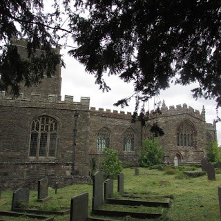
St. Beuno’s Church from the road.
On our way back to Llanberis, Dad spotted what looked to be an old Norman church. We pulled over and went to investigate. In fact, St. Beuno’s Church dates from the 1400s, and contains a number of very interesting artifacts—not the least of which is the chest that would have once held parish records. Chests such as this, which were carved out of one piece of wood, are very rare.
The other interesting thing we discovered was that St. Beuno’s Church is connected to Canada. One of its congregation members, 18-year-old Edgar Christian, travelled to Canada in 1927, and died while on a hunting expedition in the Northwest Territories. His diary was found ten years later, and has since been published under the title Unflinching. Apparently this is a “minor classic” in Canada. Although I’d never heard of it, the story intrigues me, and I have every intention of trying to find a copy once I get home.
The National Slate Museum
In the afternoon, we visited the National Slate museum in Llanberis. This museum is on the site of an old slate mine that is no longer operational. In 1882, the quarry produced 87,000 tons of slate.
The water wheel on display at the museum is 50 feet, 5 inches in diameter, and would have been used to work almost all of the equipment necessary to power the quarry, which was almost self-sufficient. The water wheel powered saws to cut wood to make repairs to company wagons and ships. Carpenters and joiners made the buildings and repaired wooden tools when they broke. A patterner made wooden models that could be pressed into the sand floor of the foundry, where molten metal was poured into the molds to make the metal tools and mechanisms required by the quarrymen and slate splitters. Nowadays, with mechanization, 12 men can do the work of 200.
The only thing still done by hand in a slate quarry is slate splitting. Depending on the grade of slate, the stone can be split into sheets as thin as 1 mm. Once split, the slates must be “dressed”—that is, cut to a certain size. Queens are the largest size, and the only ones not specified by measurement; they can be any size larger than a princess. In descending orders, the sizes are: queens, princesses, duchesses, countesses, etc. Dressing is done with a large, cleaver-like knife, and a notched ruler. A good dresser could dress up to 600 slates in a 9-hour day, if the slate was of good quality. The average number of dressed slates was between 350 and 400. This is not to say that a dresser was paid for all of these; the company took 28% of the dresser’s wage to cover the cost of slates that broke while in transit (though the number of slates that were actually broken was closer to 5%). Apprentices would travel from the surrounding villages at the age of 12 and live in the barracks at the quarry. For the first six months, they would receive no pay. The second six months, they would be paid 6 pence a day. Every year after that, their pay would increase by a shilling.
Dad had the opportunity to try his hand at splitting slate, and did a pretty good job of it!
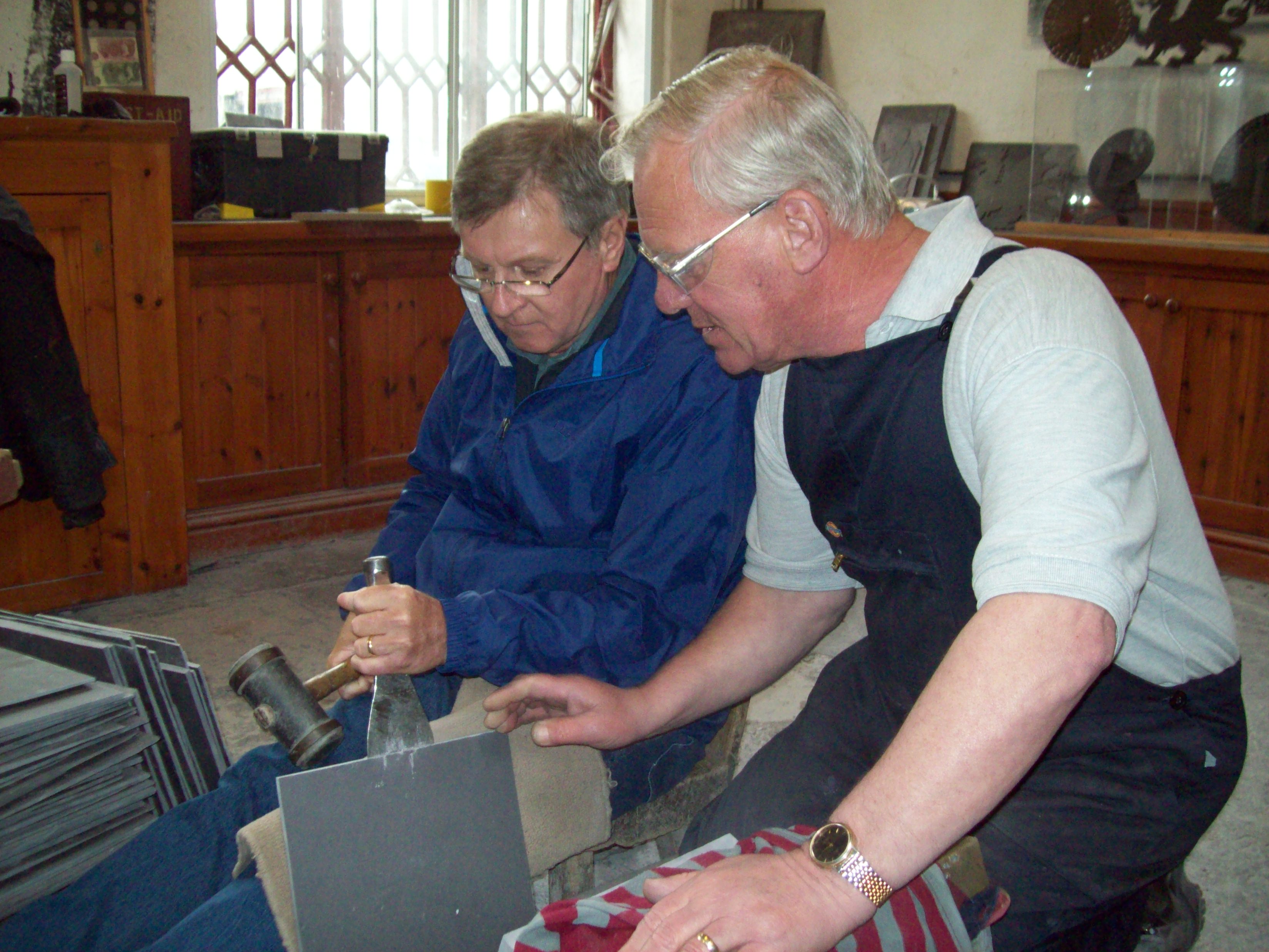
Dad splitting slate